Category:Maps of Rwanda
Jump to navigation
Jump to search
Countries of Africa: Algeria · Angola · Benin · Botswana · Burkina Faso · Burundi · Cameroon · Cape Verde · Central African Republic · Chad · Comoros · Democratic Republic of the Congo · Republic of the Congo · Djibouti · Egypt‡ · Equatorial Guinea · Eritrea · Eswatini · Ethiopia · Gabon · The Gambia · Ghana · Guinea · Guinea-Bissau · Ivory Coast · Kenya · Lesotho · Liberia · Libya · Madagascar · Malawi · Mali · Mauritania · Mauritius · Morocco · Mozambique · Namibia · Niger · Nigeria · Rwanda · São Tomé and Príncipe · Senegal · Seychelles · Sierra Leone · Somalia · South Africa · South Sudan · Sudan · Tanzania · Togo · Tunisia · Uganda · Zambia · Zimbabwe
Limited recognition: Ambazonia · Azawad · Puntland · Sahrawi Arab Democratic Republic · Somaliland – Other areas: Canary Islands · Ceuta · Madeira · Mayotte · Melilla · Réunion · Saint Helena, Ascension and Tristan da Cunha · Scattered Islands in the Indian Ocean · Western Sahara
‡: partly located in Africa
English: Maps of Rwanda
Français : Cartes du Rwanda
Wikimedia category | |||||
| Upload media | |||||
| Instance of | |||||
|---|---|---|---|---|---|
| Category combines topics | |||||
 | |||||
Subcategories
This category has the following 23 subcategories, out of 23 total.
*
- Maps of Kigali (7 F)
A
B
- Maps of borders of Rwanda (4 F)
C
E
- ECHO Daily Maps of Rwanda (11 F)
- Economic maps of Rwanda (3 F)
F
H
L
- Location maps of Rwanda (3 F)
O
- OpenStreetMap maps of Rwanda (6 F)
P
S
T
- Transport maps of Rwanda (2 F)
Pages in category "Maps of Rwanda"
The following 2 pages are in this category, out of 2 total.
Media in category "Maps of Rwanda"
The following 17 files are in this category, out of 17 total.
-
 ECHO Rwanda Editable A4 Landscape.pdf 1,754 × 1,239; 227 KB
-
 ECHO Rwanda Editable A4 Landscape.png 1,123 × 794; 241 KB
-
 Map number 3717 r11.1, September 2018.png 2,563 × 1,957; 2.44 MB
-
 Ruanda-Mappa.png 330 × 352; 12 KB
-
 Rwanda 2008 earthquake.gif 500 × 496; 22 KB
-
 Rwanda 3717 r11.1 sep18.jpg 2,563 × 1,957; 1.9 MB
-
 Rwanda and Burundi - DPLA - 917a51a98dc1e789b85cc1ac74115875.jpg 2,554 × 3,274; 5.65 MB
-
 Rwanda and Burundi - DPLA - 96b2523ed098bb286eca22d650521980.jpg 2,578 × 3,280; 4.76 MB
-
 Rwanda and Burundi - DPLA - aebd228857135c249ded4e12bc3eb59a.jpg 2,554 × 3,278; 5.66 MB
-
 Rwanda and Burundi - DPLA - bf15dd3e9b2c845f2e564efc67497580.jpg 2,546 × 3,270; 6.91 MB
-
 Rwanda Base Map.png 832 × 701; 143 KB
-
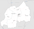
 RwandaGeoProvinces.png 327 × 317; 42 KB
-
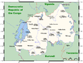 RwandaOMC.png 962 × 736; 31 KB
-
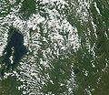 Satellite image of Rwanda in May 2002.jpg 933 × 809; 196 KB
-
 SVG-Koort Ruanda.svg 425 × 375; 37 KB
-
 Ruanda deutsch UNO-Karte.jpg 2,049 × 1,523; 881 KB
-
 Variantes du français originaires de Belgique utilisées en Afrique.jpg 1,002 × 501; 44 KB


