Category:Maps of Guyana
Jump to navigation
Jump to search
| NO WIKIDATA ID FOUND! Search for Maps of Guyana on Wikidata | |
| Upload media |

Subcategories
This category has the following 19 subcategories, out of 19 total.
B
C
D
- Demographic maps of Guyana (7 F)
E
- Election maps of Guyana (11 F)
F
H
L
O
R
S
- Maps of Guyana on stamps (2 F)
T
Pages in category "Maps of Guyana"
This category contains only the following page.
Media in category "Maps of Guyana"
The following 188 files are in this category, out of 188 total.
-
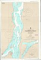
 Admiralty Chart No 2687 Approaches to the Berbice River, Published 1967.jpg 11,297 × 16,432; 20.54 MB
-
 Admiralty Chart No 2782 Essequibo River Leguan Island to Mamarikuri Island, Published 1963.jpg 11,243 × 16,357; 29.1 MB
-
 Admiralty Chart No 2783 Mamarikuru Island to Bartica, Published 1972.jpg 11,267 × 16,376; 28.95 MB
-
 CIA map of Guyana Including Disputed areas.png 329 × 353; 50 KB
-
.png/93px-Colored_Map_of_Guyana_(Neutral).png) Colored Map of Guyana (Neutral).png 6,120 × 7,920; 1.97 MB
Colored Map of Guyana (Neutral).png 6,120 × 7,920; 1.97 MB
-
 Cooperative Republic of Guiana, Map.jpg 815 × 988; 95 KB
-
.png/93px-Detailed_Map_Guyana_(Neutral).png) Detailed Map Guyana (Neutral).png 6,120 × 7,920; 2.02 MB
Detailed Map Guyana (Neutral).png 6,120 × 7,920; 2.02 MB
-
 Detailed Map of Guyana with Region Borders, places and roads.png 8,420 × 5,950; 2.15 MB
-
.png/120px-Disputed_Areas_Guianas_(Venezuela%2CGuyana%2CSuriname_and_French_Guiana).png) Disputed Areas Guianas (Venezuela,Guyana,Suriname and French Guiana).png 7,870 × 6,031; 1.5 MB
Disputed Areas Guianas (Venezuela,Guyana,Suriname and French Guiana).png 7,870 × 6,031; 1.5 MB
-
 Disputed Territories Venezuela Guyana Suriname Fr Guiana.png 8,420 × 5,950; 1.2 MB
-
 Dutch Essequibo 1800.svg 541 × 541; 128 KB
-
 ECDM 20210611 South-America Floods.pdf 1,625 × 1,125; 525 KB
-
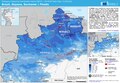
 ECDM 20210624 Guyana Floods.pdf 1,625 × 1,125; 575 KB
-
 ECDM 20240422 South America.pdf 2,479 × 1,754; 965 KB
-
 Essequibo highlighted2.png 800 × 1,131; 78 KB
-
 Essequibo rivermap.png 1,000 × 1,000; 1.4 MB
-
 Flag Map of Guyana.png 2,479 × 3,508; 363 KB
-
 FLII Guyana.png 742 × 858; 275 KB
-
 Grey Map of the Guianas.png 7,920 × 6,120; 913 KB
-
.png/120px-Guayana_Esequiba_(zona_completa_).png) Guayana Esequiba (zona completa ).png 784 × 786; 840 KB
Guayana Esequiba (zona completa ).png 784 × 786; 840 KB
-
.png/120px-Guayana_Esequiba_(zona_completa_Neutral).png) Guayana Esequiba (zona completa Neutral).png 784 × 786; 887 KB
Guayana Esequiba (zona completa Neutral).png 784 × 786; 887 KB
-
 Guayana Esequiba Disputed Area Venezuela-Guyana.png 8,420 × 5,950; 1.21 MB
-
 Guayana Esequiba Guyana–Venezuela territorial dispute.png 8,420 × 5,950; 1.49 MB
-
 Guayana Esequiba Venezuela Guyana Territorial Dispute.png 6,120 × 7,920; 1.39 MB
-
 Guyana - Location Map - GUY - UNOCHA INCL Disputed Areas.svg 882 × 882; 845 KB
-
 Guyana - Region 1 Barima-Waini Map Neutral.png 6,120 × 7,920; 1.41 MB
-
 Guyana - Region 10 Upper Demerara-Berbice Map Neutral.png 6,120 × 7,920; 1.41 MB
-
 Guyana - Region 2 Pomeroon-Supenaam Map Neutral.png 6,120 × 7,920; 1.41 MB
-
 Guyana - Region 3 Essequibo Islands-West Demerara Map Neutral.png 6,120 × 7,920; 1.41 MB
-
 Guyana - Region 4 Demerara-Mahaica Map Neutral.png 6,120 × 7,920; 1.41 MB
-
 Guyana - Region 5 Mahaica-Berbice Map Neutral.png 6,120 × 7,920; 1.41 MB
-
 Guyana - Region 6 East Berbice-Corentyne Map Neutral.png 6,120 × 7,920; 1.41 MB
-
 Guyana - Region 7 Cuyuni-Mazaruni Map Neutral.png 6,120 × 7,920; 1.41 MB
-
 Guyana - Region 8 Potaro-Siparuni Map Neutral.png 6,120 × 7,920; 1.41 MB
-
 Guyana - Region 9 Upper Takutu-Upper Essequibo Map Neutral.png 6,120 × 7,920; 1.41 MB
-
 Guyana Administrative Regions Detailed.svg 595 × 842; 510 KB
-
 Guyana Base Map with Disputed Areas.png 753 × 989; 265 KB
-
 Guyana Basemap With disputed areas.png 566 × 742; 180 KB
-
 Guyana Black Map Theme.png 5,939 × 5,939; 356 KB
-
 Guyana Blue Inner Shadow Map.png 5,939 × 5,939; 379 KB
-
 Guyana blue theme with Cast Shadow.png 5,953 × 8,419; 1,023 KB
-
 Guyana City Map.png 5,950 × 8,420; 1.09 MB
-
 Guyana Detailed Information Map.png 5,950 × 8,420; 1.72 MB
-
 Guyana Disputed Areas.svg 713 × 789; 190 KB
-
 Guyana districts.png 1,700 × 2,272; 89 KB
-
 Guyana Frans1 lokatie.png 460 × 533; 11 KB
-
 Guyana Location Map - South America.png 4,450 × 5,950; 902 KB
-
 Guyana Location Map Cropped.png 8,420 × 5,950; 1.38 MB
-
 Guyana Location Map Green Inc Disputed Area.png 5,950 × 8,420; 1,004 KB
-
 Guyana Location map including Labels.png 8,420 × 5,950; 1.9 MB
-
 Guyana Location Map South America.png 8,420 × 5,950; 1.06 MB
-
 Guyana Location Map with Disputed Areas.png 1,965 × 2,400; 5.32 MB
-
 Guyana Location on South America.svg 842 × 595; 1.97 MB
-
 Guyana Location.png 7,920 × 6,120; 993 KB
-
 Guyana Map - Disputed Areas Labels.svg 842 × 1,190; 131 KB
-
 Guyana Map - Disputed Areas.svg 842 × 1,190; 116 KB
-
 Guyana Map Incl. Esequiba and Tigri Disputed Areas.png 5,950 × 8,420; 987 KB
-
 Guyana Map Including Disputed Area.png 5,962 × 7,342; 1.23 MB
-
.png/120px-Guyana_Map_with_Disputed_Areas_(Esequiba_and_Tigri).png) Guyana Map with Disputed Areas (Esequiba and Tigri).png 3,507 × 2,480; 534 KB
Guyana Map with Disputed Areas (Esequiba and Tigri).png 3,507 × 2,480; 534 KB
-
.png/85px-Guyana_map_with_Disputed_Areas_(Venezuela_and_Suriname).png) Guyana map with Disputed Areas (Venezuela and Suriname).png 5,950 × 8,420; 1.1 MB
Guyana map with Disputed Areas (Venezuela and Suriname).png 5,950 × 8,420; 1.1 MB
-
 Guyana Map with Disputed Areas.png 2,480 × 3,509; 390 KB
-
 Guyana Media Map Blue Theme.png 5,950 × 8,420; 750 KB
-
 Guyana Media Map Including Regions.png 5,950 × 8,420; 1.29 MB
-
 Guyana neighborhood councils.png 1,281 × 878; 16 KB
-
 Guyana neighborhood councils.svg 593 × 777; 2.23 MB
-
 GUYANA orthographic.svg 550 × 550; 1.24 MB
-
 Guyana Outline Map Country Shape Black Corner Flag and Label.png 5,940 × 5,940; 317 KB
-
 Guyana Outline Map Country Shape Black Transparent Background.png 4,001 × 6,001; 326 KB
-
 Guyana Outline Map Country Shape Black With Flag.png 4,001 × 6,001; 338 KB
-
 Guyana Outline Map Country Shape Black With Label and Flag.png 4,001 × 6,001; 361 KB
-
 Guyana Outline Map Country Shape Black With Label.png 4,001 × 6,001; 323 KB
-
 Guyana Outline Map Country Shape White Corner Flag and Label.png 5,940 × 5,940; 390 KB
-
 Guyana Outline Map Country Shape White with Flag.png 4,001 × 6,001; 319 KB
-
 Guyana Outline Map Country Shape White With Label and Flag.png 4,001 × 6,001; 339 KB
-
 Guyana Outline Map Country Shape White With Label.png 4,001 × 6,001; 302 KB
-
 Guyana Outline Map Country Shape White.png 4,001 × 6,001; 282 KB
-
 Guyana Physical Map with Disputed Areas.svg 851 × 1,252; 2.66 MB
-
 Guyana Protected Areas.png 1,224 × 1,584; 218 KB
-
 Guyana Region 1 - Barima-Waini.png 5,952 × 7,691; 731 KB
-
 Guyana Region 1 - Barima-Waini.svg 595 × 769; 212 KB
-
 Guyana Region 1 Barima-Waini Map.png 6,120 × 7,920; 821 KB
-
 Guyana Region 1 Barima-Waini.png 6,120 × 7,920; 1.03 MB
-
 Guyana Region 10 - Upper Demerara-Upper Berbice.png 5,952 × 7,691; 733 KB
-
 Guyana Region 10 - Upper Demerara-Upper Berbice.svg 595 × 769; 214 KB
-
 Guyana Region 10 Upper Demerara-Berbice Map.png 6,120 × 7,920; 846 KB
-
 Guyana Region 10 Upper Demerara-Berbice.png 6,120 × 7,920; 1.03 MB
-
 Guyana Region 2 - Pomeroon-Supenaam.png 5,952 × 7,691; 731 KB
-
 Guyana Region 2 - Pomeroon-Supenaam.svg 595 × 769; 213 KB
-
 Guyana Region 2 Pomeroon-Supenaam Map.png 6,120 × 7,920; 795 KB
-
 Guyana Region 2 Pomeroon-Supenaam.png 6,120 × 7,920; 1.03 MB
-
 Guyana Region 3 - Essequibo Islands - West Demerara.png 5,952 × 7,691; 731 KB
-
 Guyana Region 3 - Essequibo Islands - West Demerara.svg 595 × 769; 213 KB
-
 Guyana Region 3 Essequibo Islands-West Demerara Map.png 6,120 × 7,920; 809 KB
-
 Guyana Region 3 Essequibo Islands-West Demerara.png 6,120 × 7,920; 1.03 MB
-
 Guyana Region 4 - Demerara-Mahaica.png 5,952 × 7,691; 731 KB
-
 Guyana Region 4 - Demerara-Mahaica.svg 595 × 769; 213 KB
-
 Guyana Region 4 Demerara-Mahaica Map.png 6,120 × 7,920; 781 KB
-
 Guyana Region 4 Demerara-Mahaica.png 6,120 × 7,920; 1.03 MB
-
 Guyana Region 5 - Mahaica-Berbice.png 5,952 × 7,691; 731 KB
-
 Guyana Region 5 - Mahaica-Berbice.svg 595 × 769; 213 KB
-
 Guyana Region 5 Mahaica-Berbice Map.png 6,120 × 7,920; 788 KB
-
 Guyana Region 5 Mahaica-Berbice.png 6,120 × 7,920; 1.03 MB
-
 Guyana Region 6 - East Berbice - Corentyne.png 5,952 × 7,691; 741 KB
-
 Guyana Region 6 - East Berbice - Corentyne.svg 595 × 769; 213 KB
-
 Guyana Region 6 East Berbice-Corentyne Map.png 6,120 × 7,920; 884 KB
-
 Guyana Region 6 East Berbice-Corentyne.png 6,120 × 7,920; 1.04 MB
-
 Guyana Region 7 - Cuyuni-Mazaruni.png 5,952 × 7,691; 734 KB
-
 Guyana Region 7 - Cuyuni-Mazaruni.svg 595 × 769; 213 KB
-
 Guyana Region 7 Cuyuni-Mazaruni Map.png 6,120 × 7,920; 903 KB
-
 Guyana Region 7 Cuyuni-Mazaruni.png 6,120 × 7,920; 1.03 MB
-
 Guyana Region 8 - Potaro-Siparuni.png 5,952 × 7,691; 732 KB
-
 Guyana Region 8 - Potaro-Siparuni.svg 595 × 769; 213 KB
-
 Guyana Region 8 Potaro-Siparuni Map.png 6,120 × 7,920; 851 KB
-
 Guyana Region 8 Potaro-Siparuni.png 6,120 × 7,920; 1.03 MB
-
 Guyana Region 9 - Upper Takutu-Upper Essequibo.png 5,952 × 7,691; 730 KB
-
 Guyana Region 9 - Upper Takutu-Upper Essequibo.svg 595 × 769; 213 KB
-
 Guyana Region 9 Upper Takutu- Upper Essequibo Map.png 6,120 × 7,920; 935 KB
-
 Guyana Region 9 Upper Takutu-Upper Essequibo.png 6,120 × 7,920; 1.03 MB
-
 Guyana Region map Blank with Rivers.png 8,420 × 5,950; 1.5 MB
-
 Guyana Region Map Green Theme.png 5,950 × 8,420; 1.41 MB
-
 Guyana Regions and Disputed Areas.png 5,950 × 8,420; 997 KB
-
 Guyana Regions English.svg 595 × 769; 246 KB
-
 Guyana Regions including Disputed Areas.png 5,950 × 8,420; 985 KB
-
 Guyana Regions Information Map.png 6,120 × 7,920; 2.22 MB
-
 Guyana Regions Map Blank.png 5,952 × 7,691; 752 KB
-
 Guyana Regions Map Grey.png 5,950 × 8,420; 802 KB
-
 Guyana Regions Map With Names.png 5,952 × 7,691; 995 KB
-
 Guyana Regions Map.png 5,950 × 8,420; 1.14 MB
-
 Guyana regions Numbered.png 5,952 × 7,691; 820 KB
-
 Guyana Regions Numbered.svg 595 × 769; 106 KB
-
 Guyana River Map.png 4,160 × 5,950; 741 KB
-
 Guyana Simple Map with Disputed Area and Flag.png 5,953 × 8,419; 469 KB
-
 Guyana Suriname Fr Guiana Location.png 7,923 × 5,176; 1.01 MB
-
.jpg/120px-Guyana_Áreas_en_disputa_(Esequiba_Venezuela_y_Tigri_Surinam).jpg) Guyana Áreas en disputa (Esequiba Venezuela y Tigri Surinam).jpg 2,708 × 2,483; 304 KB
Guyana Áreas en disputa (Esequiba Venezuela y Tigri Surinam).jpg 2,708 × 2,483; 304 KB
-
_(53736542101).png/120px-Guyana%27s_offshore_mineral_exploration_blocks%2C_producing_vessels%2C_and_proposed_projects_in_the_Stabroek_block_(May_2024)_(53736542101).png)
-
 Guyana-Suriname basin WITH EEZ AND COORDINATE GRID.png 8,415 × 5,949; 2.92 MB
-
 Guyana-Suriname basin with EEZ.png 8,415 × 5,949; 2.89 MB
-
 Guyana-Suriname Basin.png 8,415 × 5,949; 2.7 MB
-
 Guyana1 lokatie.png 460 × 533; 11 KB
-
 Guyanas.PNG 253 × 353; 6 KB
-
 High detailed map Guyana outline.png 5,699 × 8,420; 654 KB
-
 Iwokrama Forest Map 1973.png 616 × 607; 338 KB
-
 Leguan Island Map.png 2,584 × 1,719; 112 KB
-
.png/120px-Map_Guayana_Esequiba_Dispute_(ENG).png) Map Guayana Esequiba Dispute (ENG).png 8,420 × 5,950; 1.13 MB
Map Guayana Esequiba Dispute (ENG).png 8,420 × 5,950; 1.13 MB
-
.png/120px-Map_Guayana_Esequiba_Dispute_(SPA).png) Map Guayana Esequiba Dispute (SPA).png 8,420 × 5,950; 1.13 MB
Map Guayana Esequiba Dispute (SPA).png 8,420 × 5,950; 1.13 MB
-
.png/120px-Map_of_Guianas_(Guyana%2CSuriname%2CFrench_Guiana).png) Map of Guianas (Guyana,Suriname,French Guiana).png 8,420 × 5,950; 649 KB
Map of Guianas (Guyana,Suriname,French Guiana).png 8,420 × 5,950; 649 KB
-
.png/85px-Map_of_Guyana_(Flag_Background).png) Map of Guyana (Flag Background).png 2,479 × 3,508; 653 KB
Map of Guyana (Flag Background).png 2,479 × 3,508; 653 KB
-
 Map of Guyana - Tigri Disputed Area.svg 1,505 × 1,505; 831 KB
-
 Map of Guyana Borders Outline.png 8,420 × 5,950; 990 KB
-
.svg/120px-Map_of_Guyana_with_Disputed_Areas_(Tigri_and_Guayana_Esequiba).svg.png) Map of Guyana with Disputed Areas (Tigri and Guayana Esequiba).svg 579 × 384; 203 KB
Map of Guyana with Disputed Areas (Tigri and Guayana Esequiba).svg 579 × 384; 203 KB
-
 Map of Guyana with disputed areas.png 5,950 × 8,420; 881 KB
-
 Map of Guyana with Regions and places Neutral.png 6,120 × 7,920; 1.41 MB
-
 Map of Guyana, South America.png 5,950 × 8,420; 750 KB
-
 Map of Rupununi.jpg 900 × 692; 164 KB
-
 Map of the Guianas - Guyana, Suriname and French Guiana.png 2,400 × 1,800; 2.5 MB
-
 Map of The Guianas with Capital Cities.png 7,920 × 6,120; 654 KB
-
 Map of Undisputed Guyana.svg 595 × 842; 187 KB
-
 Mapa de Guyana.png 667 × 600; 128 KB
-
 Mapa de Venezuela, Guyana, Suriname, Guayana Francesa.png 3,007 × 1,587; 290 KB
-
.png/85px-Media_Map_Guyana_(including_Disputed_Area).png) Media Map Guyana (including Disputed Area).png 5,950 × 8,420; 1.31 MB
Media Map Guyana (including Disputed Area).png 5,950 × 8,420; 1.31 MB
-
 NederlandsGuyana.jpg 525 × 744; 68 KB
-
 NederlandsGuyana.png 249 × 224; 6 KB
-
 Neighborhoods of Guyana Grouped.png 5,950 × 8,420; 2.38 MB
-
 Neighborhoods of Guyana Outline.png 5,950 × 8,420; 1.35 MB
-
 Neighborhoods of Guyana Wikipedia Theme.png 5,950 × 8,420; 1.44 MB
-
 Outline Guyana Borders.png 842 × 595; 42 KB
-
 PAT - Guyana.gif 800 × 1,035; 287 KB
-
 Regions of Guyana - Blank Outline Map with Label and Flag.png 5,950 × 8,420; 813 KB
-
 Regions of Guyana - Blank Outline Map.png 5,950 × 8,420; 760 KB
-
.png/85px-Regions_of_Guyana_-_Outline_Map_with_Region_Names_(Wiki_Colors).png) Regions of Guyana - Outline Map with Region Names (Wiki Colors).png 5,950 × 8,420; 1.13 MB
Regions of Guyana - Outline Map with Region Names (Wiki Colors).png 5,950 × 8,420; 1.13 MB
-
 Regions of Guyana - Outline Map with Region Names Blue Theme 2.png 5,950 × 8,420; 1.13 MB
-
 Regions of Guyana - Outline Map with Region Names Blue Theme.png 5,950 × 8,420; 1.18 MB
-
 Regions of Guyana - Outline Map with Region Names Colored Pastel Theme.png 5,950 × 8,420; 1.16 MB
-
 Regions of Guyana - Outline Map with Region Names Colored.png 5,950 × 8,420; 1.15 MB
-
 Regions of Guyana - Outline Map with Region Names Colorful Theme.png 5,950 × 8,420; 1.11 MB
-
 Regions of Guyana - Outline Map with Region Names Darker colors.png 5,950 × 8,420; 1.15 MB
-
 Regions of Guyana - Outline Map with Region Names Light Blue Theme.png 5,950 × 8,420; 1.14 MB
-
 Regions of Guyana - Outline Map with Region Names Orange Theme.png 5,950 × 8,420; 1.16 MB
-
 Regions of Guyana - Outline Map with Region Names Pastel Theme.png 5,950 × 8,420; 1.18 MB
-
 Regions of Guyana - Outline Map with Region Names.png 5,950 × 8,420; 1 MB
-
 Regions of Guyana Including Capital.png 6,120 × 7,920; 1.03 MB
-
 Regions of Guyana with Region Names colored.png 5,950 × 8,420; 1.16 MB
-
 Suriname Location on South America.png 8,420 × 5,950; 1.06 MB
-
 TTBasin USGS.JPG 544 × 620; 56 KB
-
 Vegetation Map of Guyana.jpg 16,830 × 23,405; 35.3 MB
-
 Visa requirements for Guyanese citizens 1.png 1,425 × 625; 46 KB
-
_on_Guiana_Shield.svg/120px-Zona_En_Reclamación_(Guayana_Esequiba)_on_Guiana_Shield.svg.png) Zona En Reclamación (Guayana Esequiba) on Guiana Shield.svg 480 × 330; 564 KB
Zona En Reclamación (Guayana Esequiba) on Guiana Shield.svg 480 × 330; 564 KB
-
 Гаяна.gif 500 × 536; 44 KB


.png)

.png)

.png)


.png)
.png)


.png)
.png)


.jpg)
_(53736542101).png)


.png)
.png)
.png)
.png)


.svg)


.png)


.png)


_on_Guiana_Shield.svg)
