Atlas of Vojvodina

|
Wikimedia Commons Atlas of the World The Wikimedia Atlas of the World is an organized and commented collection of geographical, political and historical maps available at Wikimedia Commons. Discussion • Update the atlas • Index of the Atlas • Atlas in categories • Other atlases on line |
|
| ||||||||||||||||||||||||||||||||||||||||||||||||

General maps

|
Vojvodina within Serbia |
.PNG)
|
Vojvodina within Serbia |

|
Vojvodina within Serbia |

|
Vojvodina within Serbia |

|
Vojvodina within Serbia |

|
Vojvodina within Serbia |

|
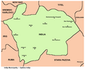
Map of Vojvodina |

|
Blank map of Vojvodina |

|
Map of Vojvodina with colours from Vojvodinian flag |

|
Map of Vojvodina with colours from Vojvodinian flag |

|
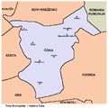
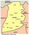
Map of districts of Vojvodina |

|
Map of districts of Vojvodina |

|
Map of districts of Vojvodina |

|
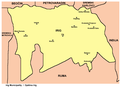
Map of the municipalities of Vojvodina |

|
Map of cities and towns in Vojvodina |
History maps
This section holds a short summary of the history of the area of present-day Vojvodina, illustrated with maps, including historical maps of former countries and empires that included present-day Vojvodina.

|
approximate extent of Pannonian Sea during the Miocene Epoch |

|
approximate extent of Pannonian Sea during the Miocene Epoch |

|
approximate extent of Pannonian Sea during the Miocene Epoch |

|
detailed map of the south-eastern part of Pannonian Sea during the Miocene Epoch |

|
detailed map of the south-eastern part of Pannonian Sea during the Miocene Epoch |

|
Starčevo culture, 7th-5th millennium BC |

|
Neolithic Starčevo culture (5300-4400 BC) |

|
Vinča culture (6th-5th milennium BC) |

|
Neolithic cultures, 4500-4000 BC |

|
Neolithic cultures, 4000-3500 BC |

|
Neolithic cultures - Vinča and Lengyel cultures, late 4th millennium BC |

|
Indo-European expansion |

|
Indo-European Vučedol culture (3000-2400 BC) |

|
Vatin culture (16th-13th century BC) |

|
Bronze Age Dubovac-Žuto Brdo culture |

|
Bronze Age Belegiš culture |

|
Iron Age Bosut culture |

|
Indo-European peoples in Vojvodina in ancient times |

|
Ethnic territory of the Illyrians and Illyrian tribes (8th-3rd century BC) |

|
Celtic expansion, 800-400 BC |

|
Tribal State of the Scordisci (3rd century BC - 1st century BC) with capital in Singidunum (present-day Belgrade) |

|
Dacian Kingdom, under the rule of Burebista, 82 BC |

|
Dacian Kingdom, under the rule of Burebista, 82 BC |

|
Ancient peoples in Pannonia |

|
Dalmato-Pannonian uprising in the first century (6 AD) |

|
Dalmato-Pannonian uprising in the first century (7 AD) |

|
Dalmato-Pannonian uprising in the first century (8 AD) |

|
Dalmato-Pannonian uprising in the first century (9 AD) |

|
Pannonia, Roman province (1st century) |

|
Pannonia, Roman province (1st century) |

|
Roman cities and provinces in middle Danube area (2nd century) |

|
Roman provinces in middle Danube area (2nd century) |

|
Pannonia Inferior, Roman province (2nd century) |

|
Pannonia Inferior, Roman province (2nd century) |

|
Territory of emperor Galerius (whose capital was Sirmium) during the Tetrarchy, 3rd-4th century |

|
Prefecture of Illyricum with capital in Sirmium, 318-379 AD |

|
Prefecture of Illyricum in the 4th century |

|
Prefecture of Illyricum in the 4th century, Gepids and Iazyges |

|
Pannonia Secunda, Roman province, 4th century |

|
Pannonia Secunda, Roman province, Goths and Iazyges, 4th century |

|
Pannonia Secunda, Roman province, 4th century |

|
Sirmium as part of the Prefecture of Italy, 395 AD |

|
Kingdom of the Gepids and Kingdom of the Ostrogoths in 500 AD |

|
Kingdom of the Ostrogoths and Gepids in 526 AD |
| [[|border|251x400px]] | Kingdom of the Gepids, 6th century |
| [[|border|251x400px]] | Kingdom of the Gepids, 6th century |
| [[|border|251x400px]] | Kingdom of the Gepids, 6th century |

|
Kingdom of the Gepids in the 6th century (539-551) |

|
Byzantine province of Pannonia, 6th century |

|
Slavs in Vojvodina in the 6th century |

|
Slavs in Vojvodina, 6th-7th century |

|
Ethnic situation in Vojvodina in the 6th-8th century |

|
Slavs in Vojvodina, 6th-10th century |

|
Avaro-Slav state, 7th century |

|
Avaro-Slav state, 7th century |

|
Slavs in Vojvodina, 7th-8th century |

|
Territory ruled by Kuver, 7th century |

|
Lands ruled by Buta-ul, 8th century |

|
Slavic Principality of Lower Pannonia in the 9th century |

|
Great Moravia in the 9th century |

|
Location of Great Moravia (9th century) in the territory of present-day Vojvodina according to the Peter Nagy Puspoki's theory |
.png)
|
Bulgarian Empire in the 9th century under khan Krum |

|
Bulgarian Empire in the 9th century under Krum and Omurtag |

|
Bulgarian Empire in the 9th century under Presian and Boris |
-TsarSimeon-byTodorBozhinov.png)
|
Bulgarian Empire in the 9th century under tsar Simeon |

|
Bulgarian Empire in the 9th century under tsar Simeon |

|
Bulgarian Empire in the 9th century under tsar Simeon |

|
Bulgarian Empire in the 9th century under tsar Simeon |
| [[|border|251x400px]] | Culture of the First Bulgarian Empire |

|
Duchies of Salan, Glad and Braslav in the 9th century |

|
Duchies of Salan and Glad in the 9th century |

|
Duchy of Salan in the 9th century |

|
Basic territory of Bijelo Brdo culture (10th-12th century) |

|
Bulgarian Empire in the 10th-11th century under tsar Samuil |

|
Duchies of Ahtum and Sermon in the 11th century |

|
Duchy of Ahtum in the 11th century |

|
Patriarchate of Ohrid in 1020 |

|
Byzantine Empire in 1025 |

|
Theme of Sirmium within Byzantine Empire in 1025 |

|
Theme of Sirmium within Byzantine Empire in 1025 |

|
Theme of Sirmium within Byzantine Empire in 1045 |

|
Religion map of the territory of present-day Vojvodina in 1054 |

|
Bulgarian Empire in the 12th-13th century under Kaloyan |

|
Bulgarian Empire in the 13th century under Ivan Asen II |

|
Bulgarian Empire in the 13th century under Ivan Asen II |

|
Bulgarian Empire in the 13th century under Constantine Tikh |

|
State of Stefan Dragutin and Domain of Ugrin Čak, 13th-14th century |

|
State of Stefan Dragutin, 13th-14th century (according to the book of historian Stanoje Stanojević) |

|
Serbian despotate, 1455-1459, including town Kovin in Banat |

|
Possessions of the Serbian despots in Syrmia, Bačka and Banat, 15th-16th century |

|
Empire of Jovan Nenad in 1526-1527 |
| [[|border|251x400px]] | Empire of Jovan Nenad in 1526-1527 and Duchy of Syrmia of Radoslav Čelnik in 1527-1530 |

|
Duchy of Syrmia of Radoslav Čelnik in 1527-1530 |

|
Growth of the Ottoman Empire |

|
Development of the European part of the Ottoman Empire |
| [[|border|251x400px]] | Ottoman Empire in 1566 |

|
Ottoman Empire in 1566 |

|
Eyalet of Temeşvar, Sanjak of Sirem, Sanjak of Segedin, and Banate of Lugos and Karansebes in 1568-1571 |

|
Eyalet of Temeşvar in 1572 |

|
Banat uprising in 1594 |

|
Ethno-religious situation in Vojvodina during Ottoman administration (16th-17th century) |

|
Serbian Patriarchate of Peć (16th-17th century) |

|
Ottoman Empire in 1600 |

|
Ottoman Empire in 1639 |

|
Eyalet of Temeşvar, Sanjak of Sirem, and Sanjak of Segedin in the middle of the 17th century |

|
Ottoman Empire in 1672 |

|
Ottoman Empire in 1683 |

|
Ottoman Empire in 1683 |

|
Ottoman Empire in 1683 |

|
Ottoman Empire in 1683 |

|
Ottoman Empire in 1683 |

|
Ottoman Empire in 1683 |

|
Eyalet of Temeşvar in 1683 |

|
Eyalet of Temeşvar, Sanjak of Semendire and Military Frontier in 1699 |

|
Approximate territory that, according to various sources, was ethnographically named Rascia (Raška, Racszag, Ráczország, Ratzenland, Rezenland) between 16th and 18th century |

|
Great Serb migration in 1690 |

|
Bunjevci migration |

|
Separate territory for the Serbs with political autonomy within Habsburg Monarchy, demanded at the Serb assembly in Baja in 1694 |

|
Ethnic map of Bačka (1715 census) |

|
Treaty of Passarowitz in 1718 |

|
Banat of Temeswar and Military Frontier in 1718 |

|
Ethnic map of Bačka (1720 census) |

|
Banat of Temeswar and Military Frontier in 1739 |

|
Districts and ethnic groups in the Banat of Temeswar in 1743 |

|
Banat of Temeswar, Kingdom of Slavonia and Military Frontier in 1745 |

|
Banat of Temeswar, Kingdom of Slavonia and Military Frontier in 1751-1778 |

|
Location map of New Serbia (1752-1764) and Slavo-Serbia (1753-1764) in modern-day Ukraine, where Serbs from Vojvodina migrated in the middle of the 18th century |

|
Location map of New Serbia (1752-1764) |

|
Detailed map of New Serbia (1752-1764) with names of the settlements. Many of the settlement names are same as settlement names in Vojvodina |

|
Location map of Slavo-Serbia (1753-1764) |

|
Detailed map of Slavo-Serbia (1753-1764) |

|
Districts and ethnic groups in the Banat of Temeswar in 1774 |

|
Vojvodina, 18th-19th century - Districts of Potisje and Velika Kikinda, Military Frontier sections in Banat, Bačka and Syrmia and Kingdom of Slavonia |

|
District of Potisje, 1751-1872 |

|
District of Velika Kikinda, 1774-1876 |

|
Banat, a separate Serb autonomous oblast - voivodeship, demanded at the Temeschwar assembly in 1790 |

|
Serbian Vojvodina in 1848 |

|
Principality of Serbia and Serbian Vojvodina in 1848 |

|
frontlines in Vojvodina in 1848-1849 |
.png)
|
Voivodeship of Serbia and Banat of Temeschwar in 1849-1860 |

|
Districts of the Voivodeship of Serbia and Banat of Temeschwar (1849-1850) |

|
Districts of the Voivodeship of Serbia and Banat of Temeschwar (1850-1860) |

|
Principality of Serbia and Voivodeship of Serbia and Banat of Temeschwar in 1849 |

|
Voivodeship of Serbia and Banat of Temeschwar in 1849-1860 |

|
Voivodeship of Serbia and Banat of Temeschwar in 1849-1860 |

|
Voivodeship of Serbia and Banat of Temeschwar in 1849-1860 |

|
Voivodeship of Serbia and Banat of Temeschwar in 1849-1860 |

|
Vojvodina in the 19th century - Military Frontier and counties in Banat, Bačka and Syrmia |

|
Ethnic map of Vojvodina in 1867 |

|
Ethnic map of Vojvodina in 1868 |

|
Slavs in Vojvodina in 1869 |

|
Ethnic map of Vojvodina in 1876 |

|
Ethnic map of Vojvodina in 1880 |

|
Counties in Bačka, Banat and Syrmia in 1881-1882 |
.jpg)
|
Ethnic map of Vojvodina in 1892 |
.jpg)
|
Dispersal of Slavs as of 1900 |
| [[|border|251x400px]] | Ethnographic map of Slavs (1902-24) |

|
Proposed State of Vojvodina within the proposed United States of Greater Austria in 1906 |

|
Proposed State of Vojvodina within the proposed United States of Greater Austria in 1906 |

|
Proposed State of Vojvodina within the proposed United States of Greater Austria in 1906 |

|
Magyarization of Vojvodina, 1720-1910 |

|
Linguistic map of Vojvodina, 1910 census |
.png)
|
Ethnic map of Vojvodina, 1910 census |

|
Ethnic map of Vojvodina in 1910 |

|
Ethnic map of Vojvodina in 1911 |
.jpg)
|
Ethnic map of Vojvodina in 1914 |
| [[|border|251x400px]] | Lands offered to Serbia by the London agreement in 1915 |

|
Ethnic map of Vojvodina in 1917 |
.jpg)
|
Ethnic map of Vojvodina, 1918 |

|
Cantonized Hungary with Serb and Bunjevci cantons, proposed by Miksa Strobl in 1918 |

|
Banat Republic in 1918 |

|
Banat Republic in 1918 |

|
Unification of Vojvodina with Serbia in 1918 |

|
Unification of Vojvodina with Serbia in 1918 |

|
Banat, Bačka and Baranja in 1918 |

|
Division of Banat in 1919-1923 |

|
Banat, Bačka and Baranja in 1920 |

|
Republic of Banatia (proposed by Banatian Germans at a Paris Peace Conference in 1920) |

|
Banat, Bačka and Baranja in 1920 |

|
Language map of Vojvodina, 1921 census |

|
Oblasts in Vojvodina, 1922-1929 |

|
Language map of Vojvodina, 1931 census |

|
Danube Banovina in 1931 |

|
Danube Banovina in 1931 |
| [[|border|251x400px]] | Danube Banovina in 1931 |
| [[|border|251x400px]] | Danube Banovina in 1931 |

|
Proposal for creation of Banovina of Serbia, 1939-1941 |

|
Proposal for creation of South German Buffer State, 1941 |

|
Occupation of Vojvodina, 1941-1944 |

|
Occupation of Vojvodina, 1941-1943 |

|
Occupation of Vojvodina, 1941-1943 |

|
Occupation of Vojvodina, 1943-1944 |
| [[|border|251x400px]] | Occupation of Vojvodina, 1941-1944 |

|
Serbia and Banat, 1941-1944 |

|
Danube Banovina, 1941 |

|
Danube Banovina, 1941 |

|
Serbia and Banat, 1941-1944 |

|
Liberated partisan territory in Syrmia in the end of 1942 |

|
Fascist genocide in Vojvodina in WW2 |

|
Fascist concentration camps in Vojvodina in WW2 |

|
Hungarian occupation of Bačka and Baranja, 1941-1944 |

|
Map of places affected by the raid in January 1942 in southern Bačka, in which Hungarian occupational forces killed 3,809 civilians mostly of Serb, Jewish and Roma ethnicity (according to historian Zvonimir Golubović) |

|
Greater Serbia in Greater Yugoslavia, proposed by Stevan Moljević in 1941 |

|
Greater Serbia, proposed by Stevan Moljević in 1941 |

|
SveSrbija ("All Serbia"), an enlarged Serbia proposed by Milan Nedić in 1943 |

|
Vojvodina from October 1944 to April 1945 - territory of Military Administration in Banat, Bačka and Baranja and Syrmian frontline |

|
SAP Vojvodina as part of SFRJ |

|
SAP Vojvodina as part of SFRJ |

|
SAP Vojvodina as part of SFRJ |

|
SAP Vojvodina as part of SFRJ |

|
SAP Vojvodina as part of SFRJ |

|
SAP Vojvodina within SR Serbia |

|
Vojvodina as part of Federal Republic of Yugoslavia (1992-2003) and Serbia and Montenegro (2003-2006) |

|
Central Balkans in 1998. |

|
Central Balkans in 2010 (de facto situation). Note: Serbia does not recognizing Independence of Kosovo. |
Ethnic, linguistic and religion maps
Ethnic maps

|
Ethnic map of Vojvodina in 1991 |

|
Ethnic map of Vojvodina in 1991 |

|
Ethnic map in 2002 |

|
Ethnic map in 2002 |

|
Ethnic map in 2002 |

|
Ethnic map in 2011 |

|
Ethnic map in 2011 |

|
Ethnic map in 2011 |

|
Serbs in Vojvodina in 2002 |

|
Serbs in Vojvodina in 2011 |

|
Hungarians in Vojvodina in 2002 |

|
Hungarians in Vojvodina in 2011 |

|
Slovaks, Rusyns and Czechs in Vojvodina (2002) |

|
Montenegrins, Bunjevci and Croats in Vojvodina (2002) |
Linguistic maps

|
Languages of Vojvodina (as of 2002) |

|
Languages of Vojvodina (as of 2011) |

|
Official usage of Serbian language and its scripts in Vojvodina (as of 2003) |

|
Official usage of Hungarian language in Vojvodina (as of 2003) |

|
Official usage of Slovak language in Vojvodina (as of 2003) |

|
Official usage of Romanian language in Vojvodina (as of 2003) |

|
Official usage of Rusyn, Croatian, and Czech language in Vojvodina (as of 2003) |

|
Serbo-Croatian language in Vojvodina (as of 2005) |

|
Serbian language in Vojvodina (as of 2006) |

|
Serbian language in Vojvodina (as of 2006) |

|
Historical distribution of Serbo-Croatian dialects (before 16th century migrations) |
| [[|border|251x400px]] | Shtokavian Serbo-Croatian dialects in Vojvodina |

|
Shtokavian Serbo-Croatian dialects in Vojvodina |

|
Shtokavian Serbo-Croatian dialects in Vojvodina |
| [[|border|251x400px]] | Shtokavian Serbo-Croatian dialects in Vojvodina |

|
Shtokavian Serbo-Croatian dialects in Vojvodina |
Religion maps

|
Religion in Vojvodina (2002) |

|
Religion in Vojvodina (2011) |

|
Eparchies and monasteries of the Serbian Orthodox Church in Vojvodina |
.png)
|
Eparchies of the Serbian Orthodox Church in Vojvodina |

|
Eparchies of the Serbian Orthodox Church in Vojvodina |

|
Eparchies of the Serbian Orthodox Church in Vojvodina |

|
Eparchies of the Serbian Orthodox Church in Vojvodina |

|
New Orthodox churches in Vojvodina |

|
Organization of the Catholic Church in Vojvodina |

|
Muftiship of Novi Sad for Vojvodina of the Islamic Community in Serbia |
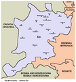
Regional maps

|
Map of Bačka region |

|
Ethnic map of Bačka region |

|
Map of Banat region |

|
Ethnic map of Banat region |

|
Map of Srem region |
.JPG)
|
Map of Srem region |

|
Map of Šajkaška region |

|
Map of Mačva region |

|
Map of Mačva region |
District maps

|
West Bačka district |

|
West Bačka district |

|
Ethnic map of West Bačka district |

|
North Bačka district |

|
North Bačka district |

|
Ethnic map of North Bačka district |

|
South Bačka district |

|
South Bačka district |

|
Ethnic map of South Bačka district |

|
Srem district |

|
Srem district |

|
Ethnic map of Srem district |

|
North Banat district |

|
North Banat district |

|
Ethnic map of North Banat district |

|
Central Banat district |

|
Central Banat district |

|
Ethnic map of Central Banat district |

|
South Banat district |

|
South Banat district |

|
Ethnic map of South Banat district |
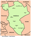
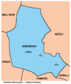
Municipality maps
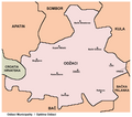
-
 Ada Municipality
 -
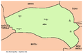
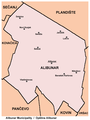 Alibunar Municipality
 -
 Apatin Municipality
 -
 Bač Municipality
 -
 Bačka Palanka Municipality
 -
 Bačka Topola Municipality
 -
 Bačka Topola Municipality, ethnic map
 -
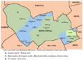
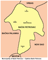 Bački Petrovac Municipality
 -
 Bečej Municipality
 -
 Bela Crkva Municipality
 -
 Beočin Municipality
 -
 Čoka Municipality
 -
 Inđija Municipality
 -
 Irig Municipality
 -
 Kanjiža Municipality
 -
 Kikinda Municipality
 -
 Kovačica Municipality
 -
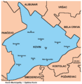 Kovin Municipality
 -
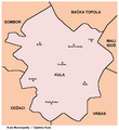 Kula Municipality
 -
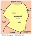 Mali Iđoš Municipality
 -
 Mali Iđoš Municipality - ethnic map
 -
 Nova Crnja Municipality
 -
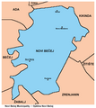 Novi Bečej Municipality
 -
 Novi Kneževac Municipality
 -
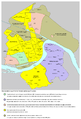
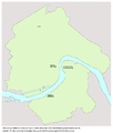
 Novi Sad City
 -
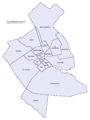
 Novi Sad City - municipalities
 -
 Novi Sad City - municipalities
 -
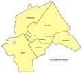
 Novi Sad Municipality
 -
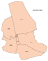
 Novi Sad - former municipalities
 -
 Odžaci Municipality
 -
 Opovo Municipality
 -
 Pančevo City
 -
 Pećinci Municipality
 -
 Petrovaradin Municipality
 -
 Plandište Municipality
 -
 Ruma Municipality
 -
 Sečanj Municipality
 -
 Senta Municipality
 -
 Šid Municipality
 -
 Sombor City
 -
 Srbobran Municipality
 -
 Sremska Mitrovica City
 -
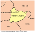 Sremski Karlovci Municipality
 -
 Stara Pazova Municipality
 -
 Subotica City
 -
 Subotica City
 -
 Subotica City - ethnic map
 -
 Temerin Municipality
 -
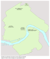
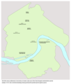
 Titel Municipality
 -
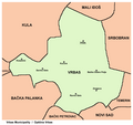 Vrbas Municipality
 -
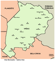 Vršac Municipality
 -
 Žabalj Municipality
 -
 Žitište Municipality
 -
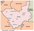
 Zrenjanin City


City maps
-
 Novi Sad - urban local communities
 -
 Novi Sad - city quarters
 -
 Novi Sad - city quarters, ethnic map
 -
 Novi Sad - prehistoric settlements
 -
 Novi Sad - ancient settlements
 -
 Novi Sad - 5th-10th century settlements
 -
 Novi Sad - 13th-16th century settlements
 -
 Novi Sad - 16th-17th century settlements
 -
 Novi Sad - 18th century settlements
 -
 Novi Sad - city development, 1716-2009
 -
 Novi Sad - former urban municipalities, 1980-1989
 -
 Subotica - urban local communities
 -
 Subotica - city quarters
 -
 Subotica - city quarters, ethnic map
 -
 Zrenjanin - urban local communities
 -
 Pančevo - urban local communities
 -
 Sombor - urban local communities
 -
 Sombor - city quarters
 -
 Kikinda - urban local communities
 -
 Sremska Mitrovica - urban local communities
 -
 Vršac - urban local communities


Old maps

|
Old map from 1528 showing settlement named Bistritz (Bistrica) in the territory of present-day Novi Sad |

|
Old map from the 16th century showing settlement named Bistritz (Bistrica) in the territory of present-day Novi Sad |

|
Old map of Banat from 1568 with the name Rasciani |

|
Old map from 1590 in which name Rascia is located in Banat |

|
Old map from first half of the 17th century in which name Rascia is located in Banat |

|
Old map from 1645 in which name Rascia is located in Banat |

|
Old map from 1661 in which name Rascia is located in Banat and Srem |

|
Old map of Novi Sad (Ratzen Stadt) with surroundings (beginning of the 18th century) |

|
Old map of Novi Sad (Ratzenstatt) with surroundings (including Almaš village) in 1716-1717 |

|
Old map of Novi Sad (Ratzen Stadt) from 1745 |

|
Old map of Novi Sad from 1745 |

|
Old map of Novi Sad from 1805 |

|
Old map of Novi Sad from 1845 |
Regional cooperation maps

|
Vojvodina as part of Danube-Kris-Mures-Tisa Euroregion, 1997-2004 |

|
Vojvodina as part of Danube-Kris-Mures-Tisa Euroregion, 1997-2004 |

|
Vojvodina as part of Danube-Kris-Mures-Tisa Euroregion, since 2004 |
Political maps

|
Local elections in Vojvodina in 2004 |

|
Local elections in Vojvodina in 2008 |

|
Local elections in Vojvodina in 2012 |

|
Republic of Vojvodina, proposed by the League of Social Democrats of Vojvodina |

|
Hungarian Regional Autonomy, proposed by the Alliance of Vojvodina Hungarians |
Notes and references
|
General remarks:
|