Atlas of Kosovo

|
Wikimedia Commons Atlas of the World The Wikimedia Atlas of the World is an organized and commented collection of geographical, political and historical maps available at Wikimedia Commons. Discussion • Update the atlas • Index of the Atlas • Atlas in categories • Other atlases on line |
|
| ||||||||||||||||||||||||||||||||||||||||||


General maps

|
Map of Kosovo |

|
Map of Kosovo |

|
Map of Kosovo, from the CIA World Factbook |

|
Topographic map of Kosovo |

|
Map of Kosovo |

|
Map of Kosovo |

|
Map of the self-proclaimed Republic of Kosovo, as recognized by some countries |

|
Map of the Autonomous Province of Kosovo and Metohija in Serbia, as recognized by other countries |

|
Blank map of Kosovo |

|
Blank map of Kosovo |
| Blank map of Kosovo |

|
Blank map of Kosovo |

|
Flag map of Kosovo |

|
Flag map of Kosovo |

|
Flag map of Kosovo |

|
Geographical regions of Kosovo |
History maps
This section holds a short summary of the history of the area of present-day Kosovo, illustrated with maps, including historical maps of former countries and empires that included present-day Kosovo.
.svg)
|
Illyrian ethnogenesis |
.jpg)
|
Prehistoric Illyrians |

|
Iron Age Glasinac culture (around 300 BC) |

|
Ethnic territory of the Illyrians and Illyrian tribes (8th-3rd century BC) |

|
Illyrian lands in the Balkans |

|
Illyrian lands in the Balkans |
.svg)
|
Illyrian lands in the Balkans |
.svg)
|
Illyrians, Illyria Barbara, Illyria Graeca, Illyrians Proper and Environs |
.png)
|
Approximate extent of the Illyrian territories prior to Roman conquest |

|
Dardanians in the Balkans |
| [[|border|251x400px]] | Dardanians in the Balkans |
.png)
|
Map of Dionysius of Syracuse's military attempts to place Alcetas in the throne of the Molossians (385 BC) - army of Illyrian / Dardanian king Bardyllis also participated in this military intervention |
.svg)
|
History of Kosovo, Classical antiquity compared to modern borders |
.png)
|
Illyrian Kingdom of Agron (250 - 230 BC) |

|
Illyrian Kingdom of Teuta (230 - 228 BC) |
.svg)
|
228 BC Adriatic Coast) |
_(English).svg)
|
228 BC Illyrian & Dardanian Kingdoms) |
.svg)
|
230 BC Adriatic Coast) |
_(English).svg)
|
230 BC Illyrian & Dardanian Kingdoms) |
.svg)
|
230-228 BC Teuta's Kingdom) |
.svg)
|
228-220 BC Roman Client state governed by Demetrius of Pharos) |
.svg)
|
237 BC Adriatic Coast) |
.svg)
|
250-230 BC Agron's Kingdom) |

|
Illyrian kingdoms of Illyria and Dardania (3rd century BC, around 230 BC) |
.png)
|
Roman Client state governed by Demetrius of Pharos (228 - 220 BC) |
| [[|border|251x400px]] | Illyrian Kingdom of Gentius 181 - 168 BC |

|
Kingdom of Dardania, 3rd-1st century BC |
.svg)
|
Ancient Dardania |
.svg)
|
Dardanian Kingdom in relation to later Roman Provinces |

|
Dardani in 6 AD |

|
Territorial development of the Roman Empire 264 BC-192, including the conquest of present-day territory of Kosovo |

|
The extent of the Roman Republic and Roman Empire; 133 BC 44 BC (late Republic, after conquests by republican generals) AD 14 (death of Augustus) 117 (maximum extension)
|

|
Camps of the Roman Legions in 80 |

|
Map of the Roman Empire in 116 |

|
Roman Empire in 117 |
,_Droysens_Historical_Atlas,_1886.jpg)
|
Dardania inside the Roman province of Moesia Superior |

|
Dardania in the Roman province of Moesia Superior from an old 1820 map |

|
Dardania in the Roman province of Moesia Superior from an old 1830 map |

|
Dardania in the Roman province of Moesia Superior from an old 1865 map |

|
Territory of emperor Galerius during the Tetrarchy |

|
Prefecture of Illyricum, 4th century |

|
Prefecture of Illyricum, 4th century |

|
Prefecture of Illyricum, 4th century |

|
Roman province of Dardania, 4th century |

|
Roman Empire divided 395, showing the dioceses and praetorian prefectures of Gaul, Italy, Illyricum and Oriens (east), roughly analogous to the four Tetrarch zones of influence after Diocletian's reforms. |

|
The division of the Empire after the death of Theodosius I, ca.395 AD superimposed on modern borders. |

|
Dardania province in the central Balkans in the Late Roman Empire |

|
Invasions of the Roman Empire 100-500 |

|
Invasions of the Roman Empire 100-500 |

|
Division of the Roman Empire in 406 |
.PNG)
|
Eastern Roman Empire and Western Roman Empire, c.476 |

|
Eastern Roman Empire |

|
Eastern Roman Empire under emperor Justinianus |

|
Eastern Roman Empire under emperor Justinianus |

|
Byzantine Empire 550 |

|
Byzantine province of Dardania in the 6th century |

|
Albanians in 5th-10th century |

|
Ethnic groups in Kosovo, 6th-8th century (according to the historical atlas for schools, published in Belgrade in 1970, representing a view of Yugoslav historians from that time) |

|
The Byzantine Empire under Basil II, c. 1025 |

|
Byzantine Empire 1025 |

|
Religion map of the territory of present-day Kosovo in 1054 |

|
The Byzantine Empire at the accession of Alexios I Komnenos, c. 1081 |
.PNG)
|
Map of the Byzantine Empire under Manuel Komnenos, c.1170. |

|
Byzantine Empire 1180 |

|
The region in 1265 |

|
The region in 1265 |

|
Medieval Serbian states |

|
The region in 1355 |

|
Map of the Serbian Empire in 1360 with territory ruled by Branković family |

|
Realm of Vuk Branković in the 14th century |

|
Realm of Vuk Branković in the 14th century |

|
Realm of Vuk Branković in the 14th century |

|
The region in 1400 |

|
Growth of the Ottoman Empire |

|
Development of the European part of the Ottoman Empire |

|
Growth of the Ottoman Empire |

|
Ottoman territories in 1455 |
| [[|border|251x400px]] | Map of the Ottoman Empire 1566 |

|
Patriarchate of Peć (16th-17th century) |

|
Location of the Ottoman Empire in 1683 |

|
Map of the Ottoman Empire 1801 |

|
Balkans after 1856 |

|
Vilayet of Kosovo 1858-1878 |

|
Sanjak of Novibazar 1878 |

|
Albanian vilayet, proposed by the League of Prizren in 1878 |

|
Albanian vilayet, proposed by the League of Prizren in 1878 |

|
Albanian vilayet, proposed by the League of Prizren in 1878 |
_map.png)
|
Vilayet of Kosovo 1881-1912 |

|
Vilayet of Kosovo in 1900 |

|
Vilayet of Kosovo in 1905 |

|
Vilayet of Kosovo in 1905 |

|
Serbian conquest in 1912 |

|
Kingdom of Serbia in 1913 |

|
Kingdom of Serbia in 1913 |

|
Kosovo in World War I |

|
Kingdom of Serbia in 1918, inclusive Kosovo |
| [[|border|251x400px]] | After World War I, Serbia became in 1918 part of the Kingdom of Serbs, Croats and Slovenes, renamed into Yugoslavia in 1929. This is a map of Yugoslavia in 1930 |

|
Kosovo in 1941 |

|
Kosovo in 1941 |

|
Kosovo in 1941 |

|
Kosovo in 1941 |

|
Kosovo in 1943 |

|
Kosovo in 1941 |

|
Kosovo in 1941-1942 |

|
Albania in 1941 (including most of Kosovo) |

|
Albania in 1941 (including most of Kosovo) |

|
Kosovo in Yugoslavia |

|
Kosovo in Yugoslavia |

|
Kosovo in Yugoslavia |

|
Kosovo in Yugoslavia |

|
Kosovo in Yugoslavia |

|
Kosovo in Yugoslavia |

|
An animated series of maps showing the breakup of the second Yugoslavia |

|
Wartime 1991 |

|
Wartime 1992 |

|
Former Yugoslavia compared with the present borders |

|
After the secession of Slovenia, Croatia, Bosnia and Herzegovina and Macedonia, Serbia (with Kosovo) and Montenegro continued as the Federal Republic of Yugoslavia, renamed in 2003 into Serbia and Montenegro |

|
Federal Republic of Yugoslavia (1992-2003) and Serbia and Montenegro (2003-2006) |

|
Federal Republic of Yugoslavia (1992-2003) and Serbia and Montenegro (2003-2006) |

|
State of Balkania (proposed by Adem Demaçi in 1993) |

|
Central Balkans in 1998. |

|
Damaged Albanian settlements in Kosovo 1998-1999 |

|
Kosovar refugees, april 1999 |

|
Significant internally displaced persons encampments in Kosovo in 1999 |

|
Map of the Operation Horseshoe, alleged Yugoslav plan to expel the Albanian population of Kosovo |

|
Sites in Kosovo where NATO aviation used forbidden munition with depleted uranium during 1999 bombing |

|
Map of Serbia and Montenegro |

|
Location of the FR of Yugoslavia (Serbia and Montenegro) before dissolution |

|
Kosovo in Serbia and Montenegro |

|
KFOR Districts |

|
UNMIK map of Kosovo |

|
Central Balkans in 2010 (de facto situation). Note: Serbia does not recognizing Independence of Kosovo. |

|
Association of Serb municipalities (2013). |
Ethnic and religion maps

|
Ethnic map in 1898 |

|
Ethnic map in 1911 |

|
Ethnic map in 1911 |

|
Ethnic map of the Balkans (1923) |

|
Ethnic map in 1961 |

|
Ethnic structure Kosovo and Metohija by settlements 1961 |

|
Ethnic structure Kosovo and Metohija by settlements 1961 |

|
Share of Serbs on Kosovo and Metohija by settlements 1961 |

|
Ethnic structure Kosovo and Metohija by settlements 1971 |

|
Ethnic structure Kosovo and Metohija by settlements 1971 |

|
Share of Albanians on Kosovo and Metohija by settlements 1971 |

|
Ethnic structure Kosovo and Metohija by settlements 1981 |

|
Ethnic structure Kosovo and Metohija by settlements 1981 |

|
Share of Albanians on Kosovo and Metohija by settlements 1981 |

|
Ethnic structure Kosovo and Metohija by settlements 1991 |

|
Ethnic structure Kosovo and Metohija by settlements 1991 |

|
Religious structure Kosovo and Metohija by settlements 1991 |

|
Ethnic map in 1991 |

|
Ethnic map in 1991 |
.png)
|
Ethnic map in 1991 |

|
Ethnic map in 2005 |

|
Ethnic map in 2005 |

|
Albanian population in Kosovo in 2005 |

|
Roma population in Kosovo in 2005 |

|
Gora Region between Kosovo and Albania |
Divisions of Kosovo

|
Regions of Kosovo |

|
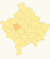
Districts of Kosovo |

|
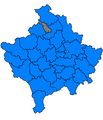
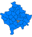
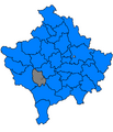
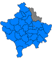
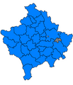
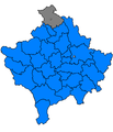
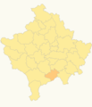
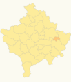
Municipalities of Kosovo |

|
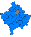
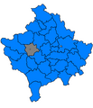
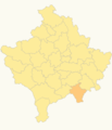
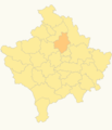
Municipalities of Kosovo |

|
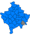
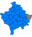
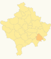
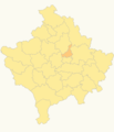
Municipalities of Kosovo |

|
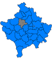
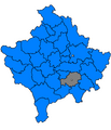
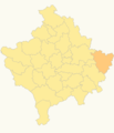
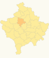
Municipalities of Kosovo |

|
Municipalities of Kosovo |

|
Municipalities of Kosovo |
| Municipalities of Kosovo |

|
Municipalities of Kosovo |

|
Cities and towns of Kosovo |

|
North Kosovo |
-
 Zveçan
 -
 Zubin Potok
 -
 Vushtrri
 -
 Viti
Viti -
 Suharekë
 -
 Skenderaj
 -
 Shtime
 -
 Shtërpcë
 -
 Rahovec
 -
 Prizren
 -
 Prishtinë
 -
 Podujevë
 -
 Pejë
Pejë -
 Obiliq
 -
 Novobërdë
 -
 Mitrovicë
 -
 Malishevë
 -
 Lipjan
 -
 Leposaviq
 -
 Klinë
Klinë -
 Kamenicë
 -
 Kaçanik
 -
 Istog
Istog -
 Gllogovc
 -
 Gjilan
 -
 Gjakovë
 -
 Fushë Kosovë
 -
 Ferizaj
 -
 Dragash
 -
 Deçan
Deçan -
 Dragash
 -
 Prizren
 -
 Shterpce
 -
 Kacanik
 -
 Viti
Viti -
 Gjilan
 -
 Kamenice
 -
 Novoberde
 -
 Ferizaj
 -
 Suhareke
 -
 Shtime
 -
 Lipjan
 -
 Prishtine
 -
 Podujeve
 -
 Leposaviq
 -
 Zvecan
 -
 Mitrovice
 -
 Vushtrri
 -
 Obiliq
 -
 Fushe Kosove
 -
 Gllogovc
 -
 Skenderaj
 -
 Zubin Potok
 -
 Istog
Istog -
 Klina
Klina -
 Malisheve
 -
 Rahovec
 -
 Gjakove
 -
 Decan
Decan -
 Peje
Peje


Politics
International recognition

|
States which have officially recognized independent Kosovo (map changes requently) (also available as SVG: Image:CountriesRecognizingKosovo.svg) |

|
An interpretation of international recognition (map changes frequently) (also available as PNG: Image:Kosovo_relations.png) |

|
A different interpretation of international recognition (map changes frequently) (also available as PNG: Image:Kosovo_relations2.png) |
Albanian context of Kosovo

|
Proposition of an ethnically accurate Albanian state |
Serbian context of Kosovo

|
Kosovo within Serbia, see also Atlas of Serbia |
.PNG)
|
Kosovo and Metohija within Serbia (in Serbian) |

|
Serbian divisions in Kosovo and Metohija |
|
|
Kosovo in a Serbia context |

|
Ethnic map of Serbia |

|
Federalized Serbia (proposed by the League of Social Democrats of Vojvodina in 1999) |

|
New regions in Serbia (proposed by the Democratic Party of Serbia in 2002) |

|
New administrative divisions (regions) of Serbia (proposed by the League For Šumadija in 2004) |
Notes and references
|
General remarks:
|