Atlas of Galicia
- See also: Category:Galicia (Spain), Galicia (España).

|
Wikimedia Commons Atlas of the World The Wikimedia Atlas of the World is an organized and commented collection of geographical, political and historical maps available at Wikimedia Commons. Discussion • Update the atlas • Index of the Atlas • Atlas in categories • Other atlases on line |
|
| ||||||||||||||||||||||||||||||||||||||||


General maps

|
Galicia |

|
Map of Galicia |
- Provinces of Galicia (location maps)
-
 Province of A Coruña
 -
 Province of Lugo
 -
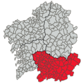 Province of Ourense
 -
 Province of Pontevedra


|
Linguistic map |

|
Detailled linguistic map of Galicia |
.png)
|
Percentage of Galician speakers |

|
Population density in Galicia |
History maps
This section holds a short summary of the history of the area of present-day Galicia, illustrated with maps, including historical maps of former countries and empires that included present-day Galicia. ====Early history====Languages of SpainLanguages of Spain.svg.svg

|
Palaeolithic art |

|
Neolithicum in Europe 5th millennium BCE |

|
Europe in ca. 4500 BC-4000 BC |

|
Europe in ca. 4000 BC-3500 BC |

|
Beaker culture |

|
Extent of the Beaker culture (ca. 2800 – 1900 B.C.) |

|
Pre-historic art in Iberia |

|
The Iberian Peninsula (Spain and Portugal) in the bronze age |


|
Ethnographic Iberia 200 BCE |

|
Prehispanic languages and tribes |

|
Prehispanic languages |

|
Paleohispanic writing systems excluding proper Lusitanian |

|
Possible extent of (proto-)Celtic influence 800-400 BC |

|
Celts in Europe |

|
Celts in Iberia (200 BC) |

|
Celts: Hallstatt (yellow) and La Tène (green) cultures |
The Romans

|
Territorial development of the Roman Empire 264 BC-192, including the conquest of present Spain |

|
The Roman Republic and Carthago in 218, just prior to the Second Punic War |

|
Hannibals invasion in the Punic Wars |

|
Roman Republic 100 BCE |

|
Map of the Roman Empire in 50 |

|
The extent of the Roman Republic and Roman Empire; 133 BC 44 BC (late Republic, after conquests by republican generals) AD 14 (death of Augustus) 117 (maximum extension)
|

|
Camps of the Roman Legions in 80 |

|
Map of the Roman Empire in 116 |

|
Roman Empire in 117 |

|
Hispania under Octavio César Augusto (29-19 a. J. C.), after the Cantabrians Wars |

|
Hispania under Dioclecian, 293 AC |

|
Roman provinces in Iberia |

|

|

|
Roman Empire divided 395 |

|
The division of the Empire after the death of Theodosius I, ca.395 AD superimposed on modern borders. |

|
Western Roman Empire 395 |

|
Invasions of the Roman Empire 100-500 |

|
Invasions of the Roman Empire 100-500 |

|
Division of the Roman Empire in 406 |
The Visigoths

|
Iberian Peninsula Around 560 AC |

|
Visigoths migrations |

|
Kingdom of the Visigoths |

|
Spain in 564 |
|
|
Visigoths and Sueves |

|
Kingdom of Suvean Galicia |
Muslim Iberia and the Christian countries

|
Conquest by the Caliphs |

|
Caliphate around 750 |

|
Europe in 814 |

|
Empire of the Almoravides (in Spanish) |

|
Empire of the Almoravides (in English) |

|
Emirate of Cordoba |
|
|
Emirate of Cordoba |

|
Taifas in 1080 |
Reconquista

|
The Reconquista |

|
The Reconquista |

|
The Reconquista |
United Spain

|
Habsburg Empire in 1547 |

|
Routes of the Armada against Britain and the Netherlands |

|
Europe under Napoleon |

|
Civil War in 1936 |

|
Civil War in 1937 |

|
Civil War in 1938 |

|
Civil War in 1939, White: Spanish Republic Grey: Fascist |
Old maps
This section holds copies of original general maps more than 70 years old.

|
Mapa del Reyno de Galicia, 1784 |

|
Spain in 1905, Bibliothek allgemeinen und praktischen Wissens für Militäranwärter Band I, 1905 |
Ethno-linguistic maps

|
Languages of Spain:
Galician, official
Astur-Leonese, unofficial
Spanish, official
Aragonese, unofficial
Catalan, official
Occitan, official
Basque, official
|

|
Languages of Spain and dialects of Castillian |

|
This would be roughly the political configuration of the Iberian Peninsula if joining many of the thoughts of nationalist and regionalist parties. A Spanish State would be composed by the traditional regions or nations of Castile (Burgos, Soria, Palencia, Valladolid, Segovia, Avila, Madrid, La Rioja, Cantabria, Toledo, Ciudad Real, Cuenca, Albacete, Guadalajara, Caceres, Badajoz, Murcia), Leon (Leon, Zamora, Salamanca, Asturias), Aragon (Huesca, Zaragoza, Teruel) and Andalusia (Huelva, Jaen, Malaga, Granada, Cadiz, Sevilla, Cordoba, Almeria), while 4 apart independent European states would be the Basque Country (Bizkaia, Gipuzkoa, Alava, Navarre), the Catalan Countries (Barcelona, Lleida, Girona, Tarragona, Castellon, Valencia, Alicante), Galicia (A Coruña, Lugo, Ourense, Pontevedra), and naturally Portugal. |
Other maps

|
ecclesiastic division map o Galicia |
.png)
|
Density of population |
.png)
|
Foreign population |

|
Main agglomerations in Spain |

|
The AVE Hight speed Railway Network |
Notes and references
|
General remarks:
|